
An Leamhaigh Mhor [Lavagh More]
Good walks are even better shared.
Overview
An Leamhaigh Mhor [Lavagh More]
Overview
An Leamhaigh Mhor is a notable Marilyn located in the picturesque Irish mountains of County Leitrim. Standing at an elevation of 775 meters, this peak offers hikers a delightful adventure through varied terrain and breathtaking views.
Geology
An Leamhaigh Mhor is made up of sedimentary rock, telling the ancient story of the region's geology. The formation dates back to when the area was once covered by a pristine sea, making it an interesting study not just for hikers, but also for geology enthusiasts.
Routes
One of the most popular routes starts at Glenfarne Forest. This moderately challenging trek spans approximately 8.5 km and takes around 3.5 hours to complete. Expect a mix of woodland paths and rocky outcrops on your way to the summit. Just remember to pack your sense of humour along with water – you might need laughter more than oxygen!
Summit Features
At the top, a humble cairn stands, inviting you to take a moment to appreciate the surrounding beauty. Friends and fellow hikers will no doubt have a chuckle or two as they pose for photos.
Terrain
The terrain is varied, with rocky sections, grassy slopes, and patches of heather. Keep your eyes peeled for bogs lurking in the grass – they can be cheeky!
Views
The views from the summit are truly breathtaking. On clear days, you can enjoy panoramic vistas of County Leitrim, including the shimmering Lough Allen. For the best visibility, spring and early autumn are the prime seasons to visit.
Hazards
As with any hike, there are certain hazards to keep in mind. Be wary of the steep rocky sections, especially during wet conditions. Weather in the mountains can change quickly, so always check forecasts before heading out.
Access
Glenfarne Forest provides convenient parking for adventurers. Nearest public transport options are somewhat limited, making a car the best choice.
Facilities
Before or after your hike, Manorhamilton has a few cafes perfect for refuelling. Remember to use the facilities available; no one wants to entertain the thought of a rough hike with an uncomfortable last stop!
History
The name 'An Leamhaigh Mhor' translates to 'the great slope,' a fitting tribute to its impressive stature. Tread these trails and you're walking through the rich cultural tapestry of County Leitrim, steeped in local legends and folklore.
Now lace up those boots, grab a buddy, and get ready to conquer An Leamhaigh Mhor!
Explore routes near An Leamhaigh Mhor [Lavagh More]
Public walks starting within 80 km of this hill. Nearby does not mean a route reaches the summit; check its map and access before setting out.
Derry~Londonderry City Walls Circuit
View route
Florence Court: Riverside and Forest Circuit, County Fermanagh
View route
Banagher Glen and Forest: complete higher-return circuit
View route
Route planning notes
These notes describe possible approaches, not verified navigable routes or permission to cross land. Check current paths, local access rules and conditions before setting out.
From Glenfarne Forest
A moderately challenging route starting from Glenfarne Forest, leading you through mixed woodland and emerging onto open heathland. The final ascent features some rocky outcrops that keep you on your toes!
Make a day of it, together
Find someone to share the walk with, or organise a day out along a route you like.
Hill facts and local notes
Classifications
Elevation
671m
2,201 ft
Prominence
193m
Coordinates
54.7669, -8.1017
G935910
OS Map
11
At the Summit
At the summit, you'll find a modest yet sturdy cairn, perfect for a brief respite or a selfie with your mates. The views will have you shouting, 'What a corker!'
Terrain & Geology
An Leamhaigh Mhor is primarily composed of sedimentary rock, showcasing the fascinating geological history of the region, characterized by old limestone formations. This geology offers insight into the ancient marine environments that once covered the area.
Views & Scenery
From the summit, gaze upon the stunning landscapes of the surrounding Irish hills, with views stretching towards the lush valleys of County Leitrim and, on a clear day, even glimpses of Lough Allen.
History & Heritage
Name Origin
The name 'An Leamhaigh Mhor' translates to 'the great slope', aptly describing this mountain's profile.
Historical Significance
This mountain is a part of the cultural tapestry of County Leitrim, associated with local myths and folklore.
Getting There & Facilities
Check current local access restrictions, parking rules and transport timetables before travelling. These notes do not confirm public access to the summit.
Parking
Parking is available at Glenfarne Forest, a short drive off the N4. It's a lovely spot to start your adventure!
Public Transport
There are limited public transport options, but local bus services operate from nearby towns. A car is recommended to reach the start point.
Nearby Facilities
You can find basic facilities in Manorhamilton, including a few cafes for a pre-hike snack and public toilets.
Safety Information
Known Hazards
- Steep rocky sections can pose a challenge, particularly when wet. Always keep an eye on the weather, as conditions can change rapidly.
General Safety Tips
- Check weather conditions before setting out
- Carry appropriate clothing and equipment
- Let someone know your planned route
- Take a map, compass, and GPS device
- Carry emergency supplies: food, water, first aid kit, torch
Hills
Some common questions about the hills answered
Are there group walks up An Leamhaigh Mhor [Lavagh More]?
Many walkers use Walkmates to join or organise walks with others. You can check for group walks around An Leamhaigh Mhor [Lavagh More] through the maps
Are there other walkers around An Leamhaigh Mhor [Lavagh More]?
Activity varies by location and time, but Walkmates lets you see whether others have shared walks or shown interest in this area. Find other people through the walking friends search walking friends for An Leamhaigh Mhor [Lavagh More] search or of course create your own walk for An Leamhaigh Mhor [Lavagh More]
Can I organise a walk to An Leamhaigh Mhor [Lavagh More]?
Yes. If there aren’t any walks listed already, you can create a walk and make it available for others to join.
If you're signed up to Walkmates, you can create a walk to An Leamhaigh Mhor [Lavagh More].
How do I find a walk up this hill?
There are often multiple ways to walk this hill, depending on experience and route preference. Walkmates helps you explore walks and routes that others have shared.
Can I suggest a new route up An Leamhaigh Mhor [Lavagh More]?
Yes. You can suggest or create routes to share with others. Walkmates focuses on the social side of walking, so routes are used to help people organise walks and explore areas together, rather than as detailed navigation tools or route libraries.
Other uses really appreciate knowledgeable walkers sharing their routes. Share your favourite route to An Leamhaigh Mhor [Lavagh More] here
The is an error or something incorrect about this hill. How do I let you know?
We always strive to keep the information on Walkmates as accurate as possible. If you find an error, please let us know through the contact form and we'll aim to correct it as quickly as possible
Community Discussion
Comments
Location
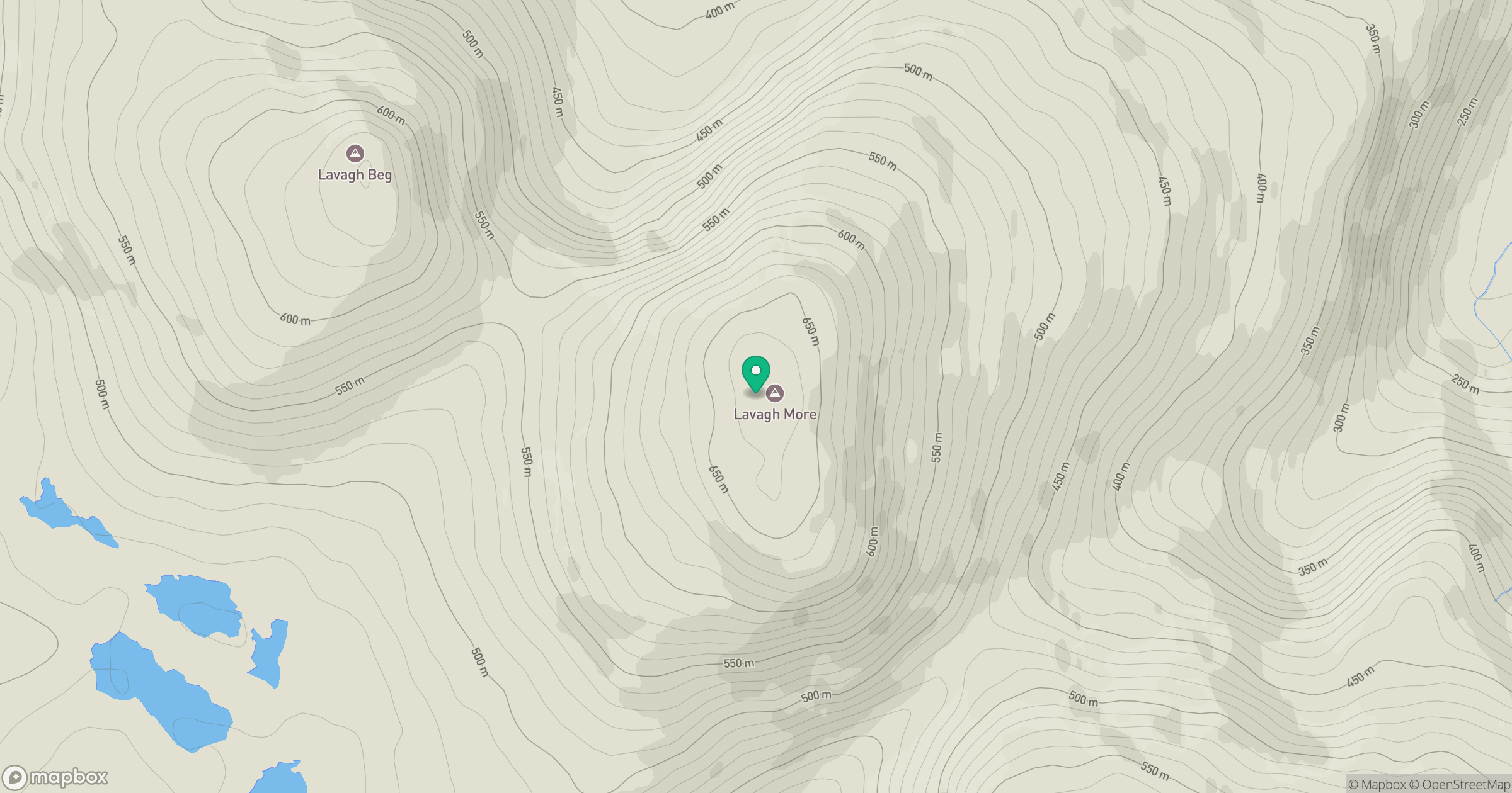
Grid reference: G935910
View on OpenStreetMapOpens a map in a new tab, centred on the hill.
Hills within 30 km
Straight-line distance, not a walking route or confirmation of access.
No comments yet. Be the first.